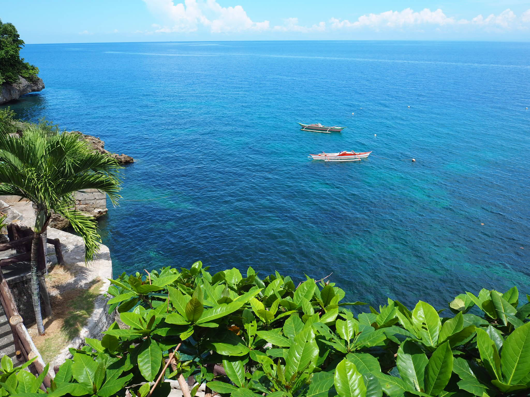
Right now Iceland is one of the most popular tourist destinations in Europe. Thanks to stunning scenery and regular spots in popular TV shows it has come to the world’s attention as a place of unrivalled natural wonders. The majority of people visit Iceland for a short period of time, usually around 5 days. They will usually do a combination of Rekjavik, the Golden Circle and the South Coast. However, with 2 weeks in Iceland, it’s very possible to do a full lap of the island and take in some of Iceland’s most stunning scenery.
I’m going to use the exact itinerary we did for our trip in September 2022. You may not want to follow it at all, but hopefully, it will give you inspiration when planning a trip of your own. Looking back the one change I would have made would have been to spend our first day in Rekjavik and only spend 1 day in the Þingvellir National Park and Golden Circle. However, hindsight is a wonderful thing.
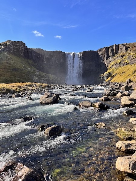
Day 1 – Keflavik to Þingvellir National Park
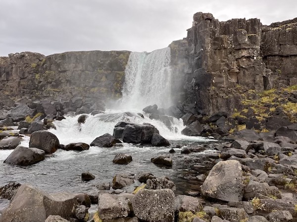
We landed at Keflavik airport just after 9 am and picked up our campervan around 10:30. From there we went shopping, grabbed some food and headed off to the Þingvellir (pronounced Thingvellir) National Park. We did a hike around the old parliament and then up to Oxararfoss. We got back to our campsite around 5 pm. After a rather pretty sunset, we received the gift of heavy rain.
Day 2 – Silfra Snorkelling, Geysir, Gulfoss and the Secret Lagoon in Fluðir
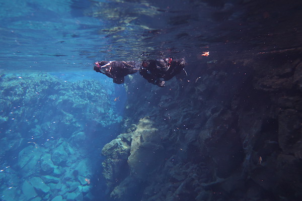
We had nothing but clear blue skies all day and managed to see a heck of a lot. Although it is expensive and very cold the Silfra Snorkelling is 100% worth doing. One of the most surreal and captivating experiences we have had. However, if you are hoping to see marine life this isn’t the right trip for you.
From Silfra it was an hour to Geysir. Geysir, which is actually the name of the largest geyser in the area, and where the name geyser comes from is actually dormant. The Srokkur geyser is the most active and erupts every 10 – 15 minutes. There are a few short hiking trails around that would be great if you have the time. However, as this is in the golden circle it tends to get quite busy.
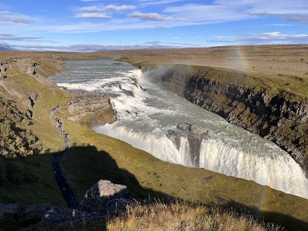
Gulfoss is another 30 minutes up the road from Geysir and is absolutely spectacular. Expect to get pretty wet whilst spotting rainbows all around you.
We ended our day by heading to the secret lagoon. Not particularly secret as it is fairly well advertised but it is much quieter than the Blue Lagoon or Myvatn. At 3000kr a person it is quite expensive for what it offers, but we really enjoyed it. The drive there is particularly pretty.
From there we drove back to our campsite in the Þingvellir National Park and were treated to a spectacular sunset en route.
Day 3 – Þingvellir National Park to Víðgelmir Lava Cave to Snaefellsnes Peninsula
We had quite a long drive heading north towards two rarely visited places in Iceland, Víðgelmir and the Snaefellsnes peninsula.
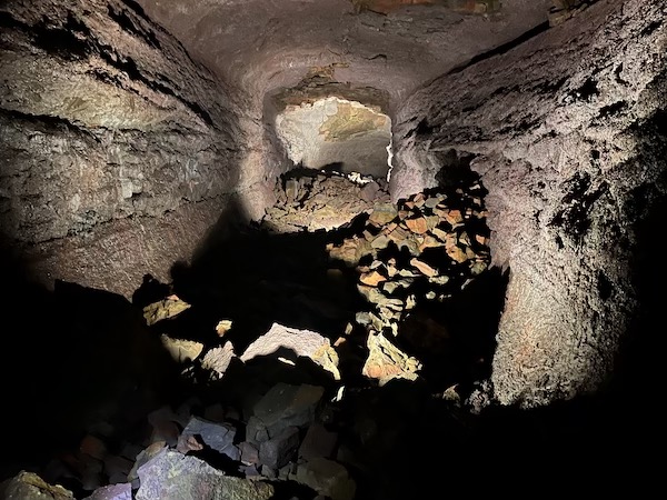
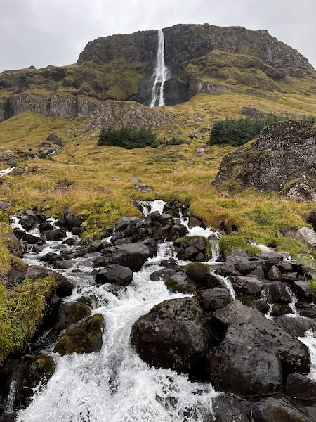
From Þingvellir it is a pretty, yet fairly bumpy ride to Víðgelmir thanks to a rather long gravel road on route 52. The cave itself has tours every 1.5 hours in the off-season. The tours are run by geologists that are working and conducting research in Iceland so they have incredible knowledge of how the cave came into existence and what creates the amazing formations inside. There is a lovely waterfall Hraunfossar close by that is definitely worth a look!
From Víðgelmir it was a long and rainy drive to the Snæfellsnes peninsula with the weather clearing just as we arrived at Bjarnarfoss on the peninsula’s south side. A gorgeous waterfall with a short hike to a great viewing platform.
Day 4 – Exploring the Snæfellsnes Peninsula
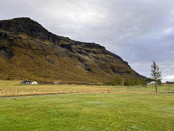
There is a lot to do on the Snæfellsnes Peninsula. Many people say it is an example of the majority of Icelandic landscapes all in one place. Sadly we started our morning with a lot of cloud coverage, meaning Snæfellsjökull was not visible from our campsite, however, over the course of the day the clouds cleared and we were blessed with some amazing views.
One of the best things about this part of Iceland is how close things are to each other, meaning you can cram quite a lot into a day. We travelled anti-clockwise around the peninsula stopping at various places en route.
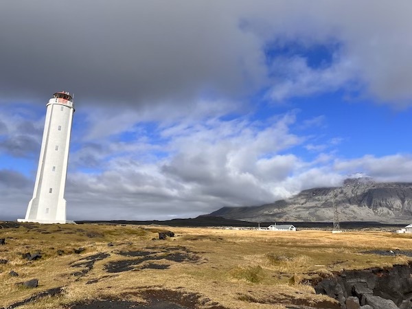
Saxholl, a volcanic crater, offers some pretty awesome views (I imagine they are even better on a less cloudy day). Just further on is the stunning Djupalon Beach, where we managed to get some clear skies. Carrying on around the peninsula you will find the Malarrif Lighthouse and Londrangar where you will find numerous short walking routes and some stunning coastal scenery.
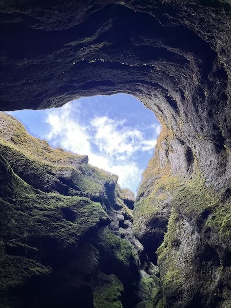
There is a lovely walk between Hellnar and Arnarstapi which is well worth doing! There is a reasonable amount of parking at either end, but more are available at Arnarstapi, so if it is busy, that’s the best place to park. We would really recommend visiting Rauðfeldsgjá Ravine. It is absolutely stunning, whether looking at the ravine itself or back along the southern coastline of the Snæfellsnes Peninsula.
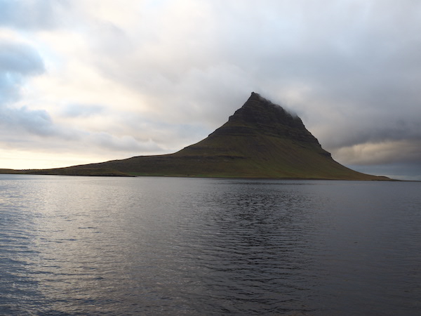
Further along the southern coastline of the peninsula, there are some other sights that definitely looked like they were worth checking out, however, sadly we were running short on time. We finished off our day by crossing the peninsula and heading to Kirkjufell, one of Iceland’s most photographed locations.
Kirkjufell is absolutely stunning and well worth a visit. It has a car park which you pay for before leaving, a surefire sign that a place is going to be fairly busy. Sadly this is a place where the tripod t**ts are out in force, expect to see plenty of people attempting to kick-start their side hustle as a travel photographer by crossing every barrier to put their tripod in front of everyone else. However, if you exit the car park, turn right and drive for about 2 minutes you will be at a parking area in front of the mountain, and you will have the entire area to yourself. Absolutely stunning.
Day 5 – Snæfellsnes Peninsula to Akureyri via the Tröllaskagi Peninsula
This was probably the longest drive we did. After much toing and froing, we had decided not to head north and explore the Westfjordlands as even with two weeks, there just wasn’t enough time to include this part of the country. However, it is a perfect excuse to return.
From the Snæfellsnes Peninsula, it is quicker to drive back down south to the town of Borgarnes before heading northeast towards the Tröllaskagi Peninsula. We stopped off at Grabrok to check out the rim of an old volcano. A great way to stretch our legs.
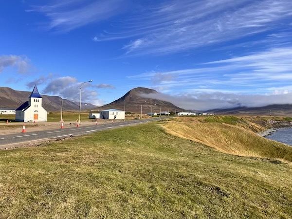
From here it was pretty much a straight drive through gorgeous scenery to the Hamlet of Hofsos, home of one of the most stunning public swimming pools in Iceland overlooking one of Iceland’s many fjords. We then followed the road and drove around the entirety of the Tröllaskagi Peninsula all the way to Akureyri. From Hofsos we saw maybe 5 other cars before we entered Akureyri and the scenery was spectacular! To top it all off we managed to enjoy the northern lights for over an hour in Akureyri.
Day 6 – Husavik
The whale-watching capital of Iceland. A quaint little fishing village on the edge of a huge bay that is home to humpback whales, dolphins, orca and sometimes fin and minke whales.
We booked a tour through North Sailing. The process was quick and easy and the boat was big and surprisingly comfortable. We were lucky enough to spot 3 humpback whales who were more than happy to hang out and keep showing their tails off.
We stayed close to the Asbyrgi allowing for easy exploration of the numerous waterfalls and hiking trails around Jokulsargljufur.
Day 7 – Asbyrgi, Jokulsargljufur, Hljodaklettar, Dettifoss, Hverir and Myvatn Nature Baths
This region of northern Iceland follows Jokulsargljufur, a canyon that is full of numerous stunning sights. There are numerous places to explore on the route that brings you on route 1 close to Myvatn.
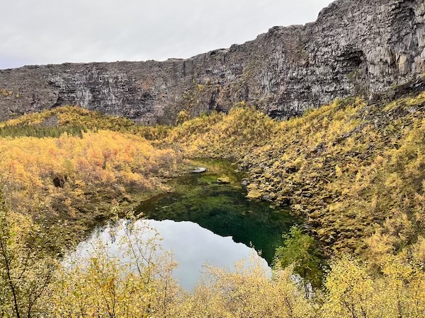
We started out at Asbyrgi, a bizarre horse-shoe-shaped geological formation. From here we headed down to the river that makes up Jokulsargljufur. Close by is the area of Hljodaklettar. A stunning set of volcanic rock volcanoes that were almost completely empty when we visited.
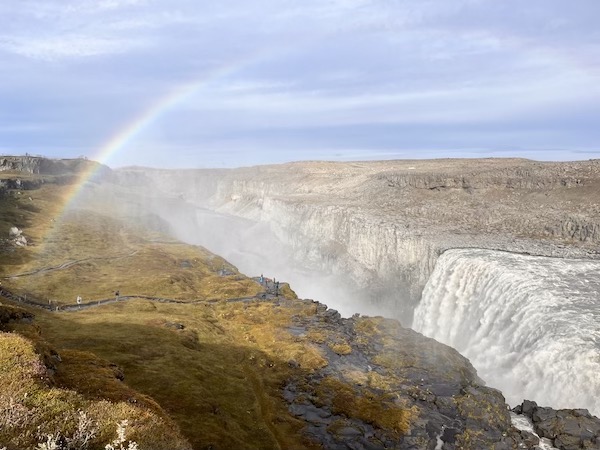
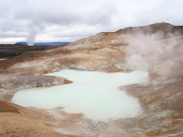
From here we continued heading south towards Dettifoss and Selfoss, two of Iceland’s most popular volcanoes. Unsurprisingly this area is quite a bit more popular than other parts of Jokulsargljufur. A short drive from Dettifoss and Selfoss is Hverir, an area of geothermal activity very close to Myvatn, if you’ve never seen anything like this before then it’s worth a visit.
We spent the evening at the stunning Myvatn Nature Baths. Whilst it is a very popular tourist destination (not as popular as the Blue Lagoon mind you), it is still well worth a visit. The baths are open until late, so by going in the early evening you can stay till closing and avoid most of the crowds!
Day 8 – Dimmuborgir, Leirhnjukur and a very long drive
Not to be confused with the famous black metal band, Dimmuborgir is a particularly pretty rock formation with plenty of walking trails and few people!
From here we took a short drive to Leirhnjukur, a lava field that at times feels like you are walking on the surface of Mars or the moon! The path from the car park takes you to a blueish, sulphur-belching pond (for want of a better description). It is here that most people trudge back to the car and carry along highway 1. However, there is a path that tasks you deep into the lava field, and most likely you will have it to yourself.
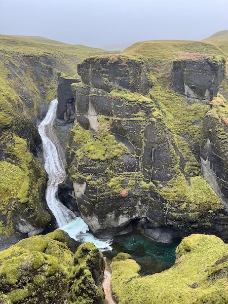
From here we followed highway 1 due east to the Egilsstaðir. There are some gorgeous waterfalls on route as well as Stuðlagil Canyon, which we sadly could not visit as we did not have a 4×4.
There are quite a few campsites along Lagarfjot, however when we visited towards the end of September these were all closed, so we stayed a Camp Egilsstaðir which was very well-equipped, but very busy.
Day 9 – Fardagafoss, Gufufoss, the South Eastern Fjords and Höfn
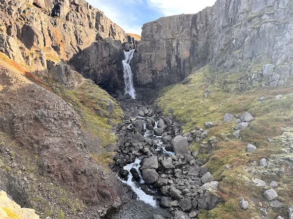
This was one of our longest driving days. We started by doing a short hike up to Fardagafoss and then driving down to Gufufoss. At both waterfalls, the scenery is pretty damn spectacular!
From here we followed to road snaking along the coast and edge of the southeastern fjords. We were lucky enough to have some fairly clear skies at times. There are plenty of places you can stop off at along highway 1. The tiny hamlet of Djupavogsvegur was certainly worth a stop as was the Hvalnes Nature Reserve.
We rolled into Höfn with the sun setting and temperature dropping. If you are a fan of gourmet food make sure you check out Pakkhus. Certainly dispels the notion of bland Icelandic cuisine.
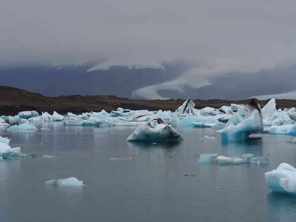
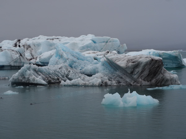
Day 10 – Jökulsarlon, Fjallsarlon, Skaftafell and Glacier Hiking
This was the first of 2 days of solid, relentless rain. In truth, Iceland really is a ‘4-seasons-in-a-day’ kind of place, much like parts of the United Kingdom and New Zealand.
After enjoying breakfast under ever-greying clouds we headed off to Jökulsarlon, a vast glacial lagoon on Iceland’s Southern coast. Almost as soon as we left the campsite the heavens opened, and didn’t stop for the next two days. However, it was the first bit of bad rain we’d experienced. It was also the first time we had experienced any real busyness in Iceland.
The vast majority of visitors come to Iceland for a few days due to the cost and the 4-day stop over at no extended cost when flying between Europe and the USA. Given the fact they are in the country for a short period of time, the Golden Circle and the South Coast represent the best bang for their buck.
Jökulsarlon was heaving by Icelandic standards. So much so that it was actually hard to find a parking space! There is a reason why this place is popular, it is truly stunning, additionally, we had never seen anything like this before, so it certainly had an extra “wow” moment. If you’re lucky you may also spot the colony of seals in the lagoon. The vast majority of people will gather at the main viewpoint, but walking five minutes down the path you will more than likely have it all to yourself. It is possible to do kayaking and boat trips on the lagoon itself. Over the other side of the road is the black diamond beach which is also worth checking out!
Another, smaller glacial lagoon, Fjallsarlon is a short drive up the road. Whilst not being quite as spectacular as its larger neighbour it is certainly much quieter.
We then headed up to the Skaftaell National Park to do a pretty awesome glacier hike, albeit in the midst of torrential rain. After we had completed the hike our rain jackets were soaked through. Originally our plan had been to stay at the Skaftafell campsite, however, there were no indoor spaces to dry stuff and cook. Not exactly ideal. A short drive back the way we came was the Svinafell campsite which I would really recommend. Very reasonably priced and a huge indoor space which allowed us to almost dry our stuff!
Day 11 – Dverghamrar, Foss á Síðu, Stjornarfoss, Systrafoss, Fjaðrárgljúfur Canyon and Vik
On another day of heavy rain, however, we still managed to pack in a decent amount. From Svinafell the drive towards Vik begins with a number of stunning glaciers. There are numerous viewpoints to hop out, stretch your legs and take a few photos.
Stjornarfoss was a bit of a hidden gem en route to the Fjaðrárgljúfur Canyon, one of Southern Iceland’s most popular sights. It wasn’t as busy as we had heard it could be, possibly because of the weather or time of year, but we had a fair few viewpoints to ourselves! With the mist and rain, it was certainly atmospheric!
We rolled into Vik just after 5 pm and booked up at the Vik campsite straightaway. This is the most popular campsite we experienced, and easily one of the most popular in the whole country. In high season I could easily see them running out of space. Showers here are 300kr for 15 mins or so. However, there is a public pool a short drive away that costs 900kr and has a sauna, hot tub, and plunge pool. Certainly more enjoyable than a campsite shower. It was chatting with a fellow traveller here that we got our idea of where to visit the next day.
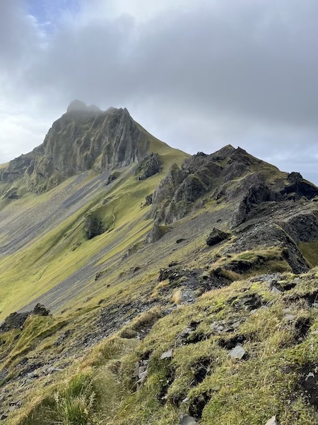
Day 12 – Westerman Islands / Vestmannaeyjar
The Westerman Islands is a small archipelago a short ferry ride from Iceland’s southern coastline. In advertisements, it is billed as Iceland’s best-kept secret, and for once the ads might just be right!
We visited on a day trip, however, it is possible to spend the night if you wish. Most visitors do not bring transport either because they are there to hike, or because they have booked a tour. We were the former.
This is one of the best places in Southern Iceland to spot puffins and as a result that is what most of the tours focus on. Most of these tours head down to the southern part of the island, which is not really possible to get to without transport.
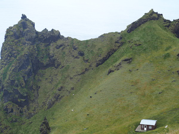
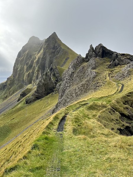
We headed up on a hike that took us along a path along the ridge of the island’s northwestern cliffs. We were absolutely blown away. The views were magnificent and we even managed to spot a few puffins around the cliffs!
If you want to get off the tourist trail in Iceland, then you really can’t get better with this hidden gem.
Day 13 – Skogafoss, Kvernafoss, Seljalandsfoss and Rekjavik
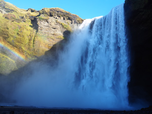
We’d spent the previous night at a quiet campsite in the village of Hvolsvollur (definitely a better choice than going back to Vik), so we doubled back to visit one of Iceland’s most popular waterfalls, Skogafoss. Its popularity comes from its size and close proximity to Rekjavik. Therefore don’t be surprised to see a fair few tourist buses waiting idly in the parking lot.
Expect some lovely scenery and min rainbows. The walking trail takes you to a bunch of other waterfalls that the majority of bus tourists seem to skip.
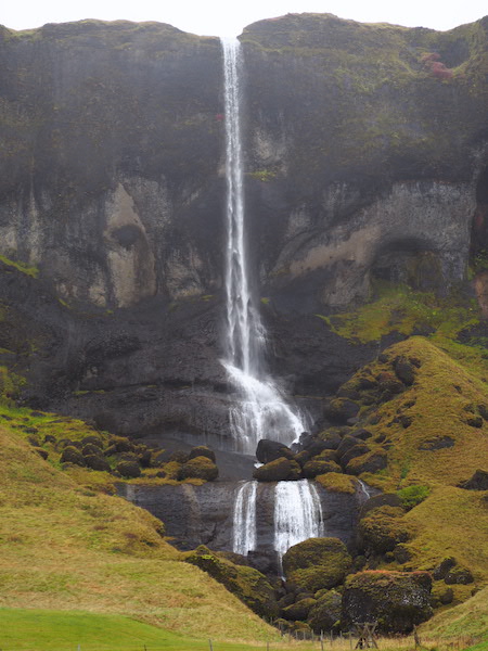
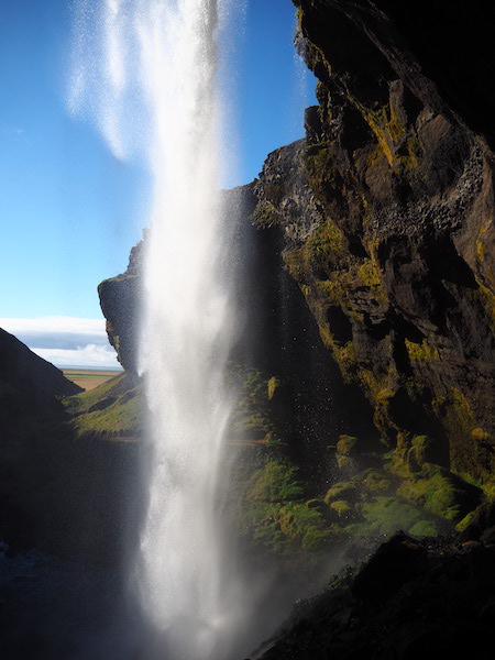
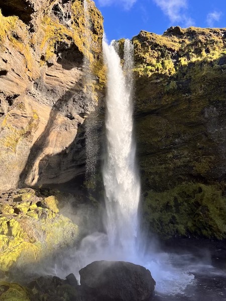
A short (like really short, maybe 3 minutes) drive from Skogafoss is probably Iceland’s most stunning waterfall (in our opinion at least), Kvernafoss. The fact that this waterfall is practically deserted whilst Skogafoss is inundated with tourists left us scratching our heads. One of the most unique things about Kvernafoss is that you can actually go behind the waterfall itself. In fact, we had Skogafoss to ourselves for almost half an hour!
We checked out Seljalandsfoss on our way to Rekjavik. However, it was pretty busy and to be honest, looked fairly unpleasant after having Kvernafoss to ourselves.
After getting to Rekjavik we took a wander through the city centre and checked out the Hallgrimskirkja.
Day 14 – Rekjavik and Home
We spent the morning exploring the national museum and then headed back to Keflavik to drop off our campervan.
There is public transport to and from the city centre. However, the cost of parking means that it is actually more economical to drive than take a bus. This website has some useful parking information.